
Urban Design
Our approach to urban design begins with an understanding of the site's existing architectural language, landscape, topography and the morphology of its open spaces. We use these qualities to establish the physical structure of the development. Public spaces, pedestrian movement and landscape form the framework within which buildings are organized, creating environments with a strong spatial identity that respond to both their setting and the needs of the people who use them.


.jpg)

Urban Design
Our approach to urban design begins with an understanding of the three-dimensional morphology of open spaces in the surrounding area. This provides a basis for determining the spatial structure of the new development, whether extending the existing character into the site, introducing a contrasting identity, or combining the two. Public spaces, pedestrian movement and landscape then form the framework within which buildings are organised, creating environments with a strong spatial identity that respond to the needs of existing and future communities.


Arghavan Village
A hillside residential community organised around a central valley preserved as a public park. The masterplan was awarded first prize in a provincial design competition.


Arghavan Village, Central Park


Abu Musa
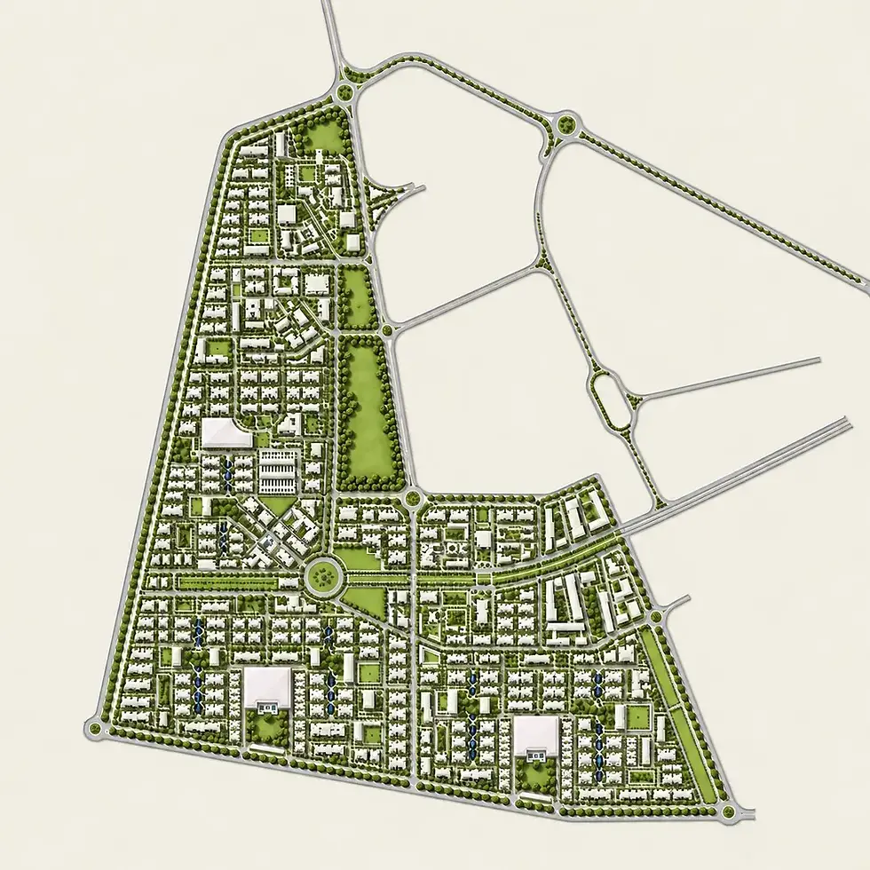
Designed for a new neighbourhood of approximately 1,200 residents, the masterplan is organised around a hierarchy of public spaces. A central neighbourhood square, reinforced by focal public buildings, forms the heart of the development, while a series of smaller sub-neighbourhood spaces provide local gathering places within walking distance of every home. Together, they create a clear spatial structure and strengthen the identity of the neighbourhood.
Nishapur cultural and commercial complex
A 7,600 m² cultural and commercial complex within a conservation area, organised around four courtyards and a central square adjoining the historic mosque.
Abu Musa
Designed for a new neighbourhood of approximately 1,200 residents, the masterplan is organised around a hierarchy of public spaces. A central neighbourhood square, reinforced by focal public buildings, forms the heart of the development, while a series of smaller sub-neighbourhood spaces provide local gathering places within walking distance of every home. Together, they create a clear spatial structure and strengthen the identity of the neighbourhood.


Abu Musa
Designed for approximately 1,200 residents, the neighbourhood contains two-storey houses structured around a central square and a series of smaller sub-neighbourhood spaces.


Majlesi New Town
Designed for approximately 20,000 residents on a 200-hectare site, Majlesi was one of the first new towns of its scale in Iran to place urban design at the centre of the planning process. The project won first prize for urban design in a national assessment of major post-revolution development projects.


Tourism and leisure development
A 170-hectare development structured around a network of public squares, with around 100 hectares at its heart designed as a largely car-free environment.


Ofogh Arghavan
A 1.1 million m² mixed-use development within an existing woodland, designed jointly by Avijeh Mehr and Bavand around two interconnected public squares while responding to the natural character of the woodland.
.jpg)
.jpg)
Baharestan neighbourhood centre
One of eight neighbourhood centres for Baharestan New Town designed by Avijeh Mehr, inspired by the organic structure of traditional neighbourhoods in Isfahan.


Sadra New Towns
A detailed plan for approximately 50,000 residents on a 500-hectare site, where a large number of small hills shaped the layout and helped create a series of distinctive neighbourhoods.


Sadra New Towns
Designed for approximately 50,000 residents on a 500-hectare site near Shiraz, the masterplan responds to the natural topography while establishing a series of distinctive neighbourhoods within a coherent urban framework. Public open spaces, neighbourhood centres and carefully positioned landmarks give each neighbourhood its own identity, while an integrated pedestrian network and landscape structure unify the development as a whole.


The Roundabout
An existing traffic roundabout transformed into a pedestrian public square by relocating traffic below ground, with approximately 15,000 m² of facilities beneath.


Yazd Conservation Area
Reconstruction of depleted parts of a historic neighbourhood, using its existing architectural language to preserve the continuity of the historic urban fabric.
Urban Planning
Our urban planning work at Tous balances the protection of its historic and archaeological heritage with future population and tourism growth, while responding to water scarcity and the need to preserve agricultural land and existing settlements.
Tous structure plan
The 2,300-hectare structure plan provided for population growth from approximately 31,000 to 51,000 while retaining existing settlements and most agricultural land. Through-traffic was redirected to perimeter roads, allowing a tree-lined pedestrian boulevard to link the main squares and neighbourhood centres and form the structure of the plan.


Tous structure plan
A 2,300-hectare structure plan accommodating population growth while retaining existing settlements and most agricultural land and redirecting through-traffic to perimeter roads.


Tous master plan
A 1,860-hectare town masterplan coordinating neighbourhoods, development areas, public open spaces and the pedestrian network.


Tous historic area master plan
A 360-hectare masterplan protecting the Tomb of Ferdowsi, archaeological remains and existing settlements within a largely pedestrian environment.
© 2026 Avijeh Mehr . All Rights Reserved
© 2026 Avijeh Mehr . All Rights Reserved
